DeepC LiDRAR

Exclusively licensed to Woods Hole Group

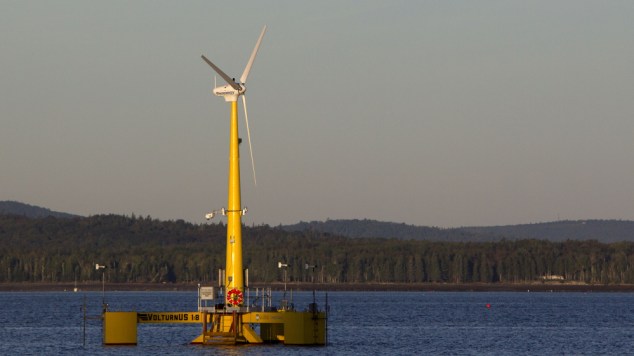
| The first floating LiDAR buoy validated in the US providing bankable wind speed data at hub height, metocean data, and ecological monitoring services.

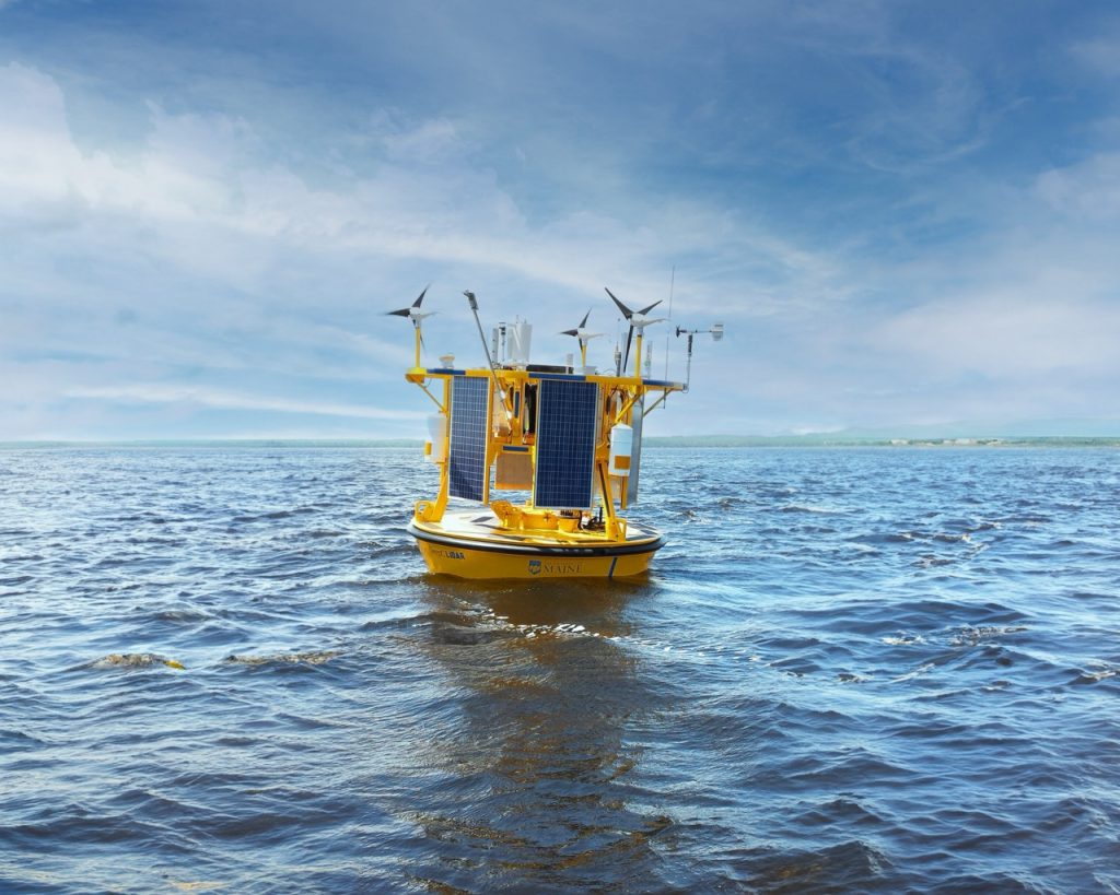
DeepCLiDAR – Offshore Wind Resource Assessment Buoy

Publication: Validation of the first LiDAR wind resource assessment buoy system offshore the Northeast United States

“Based upon the results of this test, and cumulative results of the two previous phases, AWST concludes that the DeepCLiDAR meets the Carbon Trustís acceptance criteria, and is capable of accurately measuring wind speeds and directions across the range of meteorological and ocean conditions observed during the campaigns. 

“Having successfully completed these validation exercises, the DeepCLiDAR has demonstrated a ‘Pre-commercial’ level of maturity. Sufficient performance data are now available to assess the system’s uncertainty when operating in similar environmental conditions. 

“AWST considers this system valid for use in an offshore wind resource and design condition assessment campaign in similar metocean conditions.”

DeepCLiDAR will help accelerate the development of the US offshore wind industry by providing the following: high-quality, low-cost offshore wind resource data; metocean monitoring; and ecological characterization capabilities in remote marine environments

INNOVATION

High-quality, low-cost offshore wind resource data

  • 1/10 the cost of a traditional meteorological tower for wind resource assessments
  • Deployable in virtually any water depth
  • Capable of providing bankable wind speed data up to 200m above sea-level
    Fully-integrated metocean sensor package provides wave and current data
  • Optional ecological monitoring sensor package for permitting efforts developed
    with the Biodiversity Research Institute

DEVELOPMENT

  • The buoy design was developed by the University of Maine’s Advanced Structures and Composites Center to meet the growing needs for a single instrumentation package capable of providing low-cost offshore wind resource assessments, metocean monitoring, and ecological characterization capabilities.
  • The design was produced in close consultation with LiDAR suppliers as well as AWS Truepower, a world leader in wind resource measurement and sensor validation.  It was developed in partnership with Dr. Neal Pettigrew of the UMaine Physical Oceanography GroupAWS Truepower, and NRG Renewable Systems.
  • DeepCLiDAR incorporates LiDAR technology that has achieved GLGH Stage 3 acceptance for use in formal wind resource assessment campaigns. Therefore, it is widely considered as an acceptable replacement for standard met masts in simple terrain.
  • Now Licensed exclusively to Woods Hole Group

TECHNOLOGY

LiDAR

  • Windcube Offshore®, measures wind speed at 40m – 200m heights
  • GLGH Stage 3 acceptance for use in formal wind resource assessment campaigns

Other Sensor Packages

  • Metocean: wave, wind, and current
  • Ecological: acoustic, bird, bat, and fish

Hull Type and Construction

  • Aluminum, 3m discus buoy, fully seal welded with a main central hatch for all data and power control electronics

Telemetry

  • GOES, CDMA/GSM, IRIDIUM

Mooring

  • Shallow water: chain with gravity anchor
  • Deepwater: chain/wire/chain with gravity anchor

Power

  • The system is autonomous, deployable for 1 year without regular maintenance

Media Gallery


Harness More
Data with
DeepCLiDAR.

Recent News


In Ocean Energy Engineering